Subvalleys & folds:
Javorová dolina
Ľadová/Suchá dolinka
Zadná javorová dolina
Čierna Javorová/Kolová dolina

| Home site | High Tatras - Javorov� dolina | |
| Subvalleys & folds:
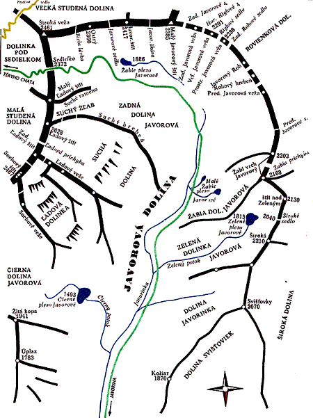
Javorová dolina | Javorová dolina is one of the large valleys on N side of Slovakian part of Vysoké Tatry. The valley is 7 km long, it has several side valleys and it is opened to NW and N. It is separated from Bielovodská dolina (including side valleys) by the ridge of Javorové veže and massif of Široká. It is separated (on S and E) from valleys on southern part of Vysoké Tatry by the main ridge of VT and the N boundary of the valley is W part of Belianske Tatry (mountain chain). The valley is wooded in lower and middle section. The upper section of the valley is called Zadná dolina Javorová. The side valleys (several larger and smaller valleys) are: dolinka Javorinka, Zelená dolinka Javorová, Žabia dolinka Javorová, Suchá dolina, Čierna Javorová dolina, Kolová dolina and Zadné Meďodoly. The prominent peaks above this valley (+ side valleys) are these: Široká, Malý Javorový štít, Javorový štít, Ostrý štít, Široká veža, Malý Ľadový štít and Ľadový štít. There is a mountain stream running down the valley called Javorinka and there is green hiking trail as well. Getting there: From Javorina (village) you shall follow the green hiking trail until you reach the junction at the TANAP (National park administration) lodge (0,5 hour). Follow the green hiking trail and continue up the valley (2 ,5 - 3,5 hour). |
 |